Donate to Our Spring Campaign or Bid on our Spring Auction to Support Forecasting

Forecast for the Ogden Area Mountains

Drew Hardesty
Issued by Drew Hardesty on
Sunday morning, February 28, 2021
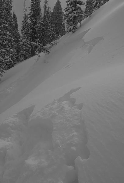
Areas of CONSIDERABLE DANGER exist in the upper elevations. Human triggered avalanches are likely on recently wind drifted terrain. A MODERATE AVALANCHE DANGER exists on all other aspects of the mid and upper elevations for lingering new snow instabilities. Some avalanches may have the potential to step down into older weaker layers 3-6' deep in localized terrain on west to north to southeast facing slopes.
SAFE TRAVEL HABITS SAVE LIVES
* Make a plan and keep track of each other
* One at a time through steep terrain
* Get out of the way at the bottom
* Carry and know how to use rescue gear
Low
Moderate
Considerable
High
Extreme
Learn how to read the forecast here
Special Announcements
Monday's Livestream recording of the Wilson Glades avalanche accident debrief and review can be found on our YouTube channel HERE and on the UAC podcast.
Weather and Snow
Skies are clearing.... Winds are light from the northwest.
Temperatures are hovering in the single digits and low teens.
Another inch of new overnight and we're up to 20-24" for the storm.

For today, we'll have sunny skies, light northwest winds and mountain temps in the low teens up high, the low 20s down low.
The Outlook: A low amplitude ridge builds in for the next several days accompanied by a warming trend. Even by tomorrow, we'll see mountain temperatures up high heading into the upper 20s. We'll have mostly sunny skies, light wind, and warming temps through the week until an abandoned cut-off Low pressure system moves in from the southwest on Thursday.

Greg Gagne's patented Week in Review can be found HERE. It covers Friday Feb 19- Thursday 25th
Recent Avalanches
Ski area avalanche teams triggered fresh wind drifts and other new snow soft slab avalanches with ski cuts and explosives. In the backcountry, a skier intentionally triggered a new wind drift near the Bailey Spring in the Ben Lomond area. The soft slab was 12" deep and 40' wide on an east facing slope at 8600'. (photo below0
You can read all the recent observations HERE.
Ad
Avalanche Problem #1
Wind Drifted Snow
Type
Location
Likelihood
Size
Description
Lingering soft wind drifts may still be triggered at the mid and upper elevations today. They won't be a sensitive as yesterday, but don't let the third wind pillow take you by surprise. Remember that the wind drifts may be well off the ridgelines where they might be cross-loaded into gulley features and to the lee of rocky outcroppings. Careful evaluation is key. While drifts will be most pronounced on north to east to south facing aspects, terrain channeling and eddying allows for drifts to be deposited on all aspects, particularly at the mid-elevation.
TREND: Decreasing danger

CORNICES HAVE GROWN SIGNFICANTLY IN THE PAST MONTH AND SHOULD BE TREATED WITH GREAT CAUTION.
Avalanche Problem #2
Persistent Weak Layer
Type
Location
Likelihood
Size
Description
Our deep slab avalanches, while becoming increasingly stubborn, can roar back to life with any additional stress, ie: heavy snowfall, strong winds, etc. Cornices may also be a good trigger for these larger avalanches. We haven't heard of any avalanches into this old layering 3-6' deep for awhile...and they may be more common north toward the Logan area...and south toward the Bountiful/Sessions areas....but they very much remain central to my route selection. These deeper slabs exist on west to north to southeast facing slopes at the mid and upper elevations are you are more likely to trigger these in steep, thin, rocky terrain or areas that may have avalanched during previous cycles.
These avalanches are tricky insofar that immediate signs of instability are often not present and it's easy to be lured onto slopes with other tracks, particularly when snow depths and snow tests might point "stable". The problem is the wide spatial variability across many slopes where you might hit the trigger point here (where the slab is thinner) but not there (where the slab is thicker).
My travel advice is to continue to avoid being on or beneath steep terrain where the facets in the basement exist.
Trend: Steady
Avalanche Problem #3
New Snow
Type
Location
Likelihood
Size
Description
Loose snow avalanches (sluffs) may be expected in the new snow on all aspects on slopes approaching 40° in steepness. Loose snow avalanches will start at a point (they're also known as point-releases) and fan out, picking up mass and speed, depending upon the fall line below.
Trend: Decreasing danger
Additional Information
Forecaster's Corner:
I expect it will be a feeding frenzy of powder skiing and riding today and over the next several days. I know you're hungry. Please pause to thoroughly evaluate your plans and be aware of who or what might be above or below you in the coming days. Moderate is not the new Low; avalanches can still be triggered....and I wouldn't be surprised to see a close call today or in the coming days. Take care of each other out there. -
General Announcements
Please visit this website with information about Responsible Winter Recreation by the Utah Office of Outdoor Recreation.

This information does not apply to developed ski areas or highways where avalanche control is normally done. This forecast is from the U.S.D.A. Forest Service, which is solely responsible for its content. This forecast describes general avalanche conditions and local variations always occur.