Donate to Our Spring Campaign or Bid on our Spring Auction to Support Forecasting

Forecast for the Ogden Area Mountains

Drew Hardesty
Issued by Drew Hardesty on
Monday morning, March 6, 2023
Areas of CONSIDERABLE avalanche danger exist in the mid and upper elevations. Human triggered avalanches are likely. Soft slabs and sluffs in the new snow are to be expected and not limited to usual starting zones...
***Cautious route finding and conservative decision making today is essential.***
Low
Moderate
Considerable
High
Extreme
Learn how to read the forecast here
Special Announcements
To help you safely enjoy the backcountry, the UAC team is constantly evaluating and implementing new programs and technologies. Donate to the Spring Campaign to help our team implement innovative tools and better provide you with the information you rely on.
Thank You!
Weather and Snow
Come, let's go
Snow-viewing
Til we're buried.
--- Matsuo Bashō (1644-1694)

We are still living in a snow globe.
Overnight snow totals are 6-8" with storm totals of 16-22" and near 2.0" snow water equivalent on Ben Lomond.
Mountain temperatures are in the teens. Winds, mercifully, are generally light from the west. Along the highest ridgelines, they blew from the northwest for a few hours this morning with hourly wind speeds of 20-30mph with gusts to 40.

For today, we'll see light snowfall that may add up to another 1-3" of fairy dust. Temperatures will be in the teens and low 20s. Winds will remain light from the west.

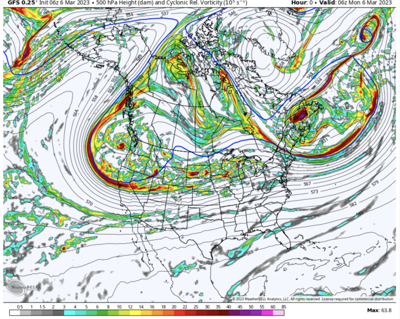
We (the intermountain west) are buried beneath a long wave trough that will continue to keep at least light snowfall going off and on through Wednesday evening. We stay relatively cool with generally light to moderate wind. The next series of storms fire up on Friday. The image below - you can see we're nested in the cradle of storms.
Recent Avalanches
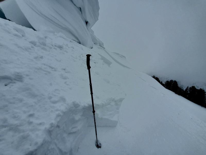
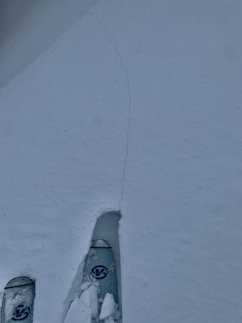
Pro observer Joe Keeler provided a great report from his outing near Ben Lomond yesterday. He intentionally dropped a cornice that triggered a fresh wind slab 18" deep and 150' wide. (photo) We did hear another report of a human triggered slide in Hells Canyon of the Snowbasin backcountry.
Ski area teams triggered numerous soft slab avalanches, the largest triggered far away from an explosive. It was 1-2' deep and 500' wide.
Check recent observations from the backcountry in the menu bar above.
Ad
Avalanche Problem #1
New Snow
Type
Location
Likelihood
Size
Description
You will be able to trigger new snow avalanches big enough to kill you in steep terrain today. Both soft slab avalanches and loose snow sluffs are likely on a variety of aspects and elevations.
I would approach any steep terrain with caution today. Ski cuts on test slopes and cornice drops should give some information on stability. Shooting cracks indicate instability as well. (photo below)
Avalanche Problem #2
Wind Drifted Snow
Type
Location
Likelihood
Size
Description
Yesterday's wind drifts will be buried by the overnight snow, but overnight fresh soft slabs of wind drifted snow may be found primarily along the higher elevations today. These will be sensitive to human weight.
Additional Information
Forecaster's Corner:
Local Wasatch resident Ian McCammon holds a PhD in robotics but can tell us a lot about human behavior. His research into avalanche accidents led him to an algorithm called ALPTRUTH.

The TAKE HOME here is that you already have three checked boxes before you even leave the house.
The terrain choice is yours.
General Announcements
This information does not apply to developed ski areas or highways where avalanche control is normally done. This forecast is from the U.S.D.A. Forest Service, which is solely responsible for its content. This forecast describes general avalanche conditions and local variations always occur.