Donate to Our Spring Campaign or Bid on our Spring Auction to Support Forecasting

Observation: Little Cottonwood Canyon

Observation Date
3/14/2025
Observer Name
Kelly
Region
Salt Lake » Little Cottonwood Canyon
Location Name or Route
Little Cottonwood Canyon
Weather
Sky
Overcast
Precipitation
Light Snowfall
Wind Direction
South
Wind Speed
Moderate
Weather Comments
Light to moderate southerly winds which picked up around 9,500' in elevation. Skies were overcast above 9,300' and broken with some light clouds and sun below that elevation. Winds decreased and temperatures increased throughout the day.
Snow Characteristics
New Snow Depth
18"
New Snow Density
Medium
Snow Surface Conditions
Powder
Snow Characteristics Comments
18" of settled snow depth that took some heat on south and east facing aspects after 2PM. There was a slight melt-freeze crust on these aspects later in the afternoon. I never felt any direct green-housing, but there was some warming. Light snow fell during the day.
Red Flags
Red Flags
Heavy Snowfall
Avalanche Problem #1
Problem
New Snow
Problem #1 Comments
Earlier in the morning, I noticed shallow soft slab avalanches running on a density change within the newest snow. This seemed to settle out as the day went on, and you really needed steeper terrain greater than 35° to get anything to move in the new snow. I would guess in higher elevation more wind-affected terrain that the new snow would be more reactive.
Avalanche Problem #2
Problem
Wind Drifted Snow
Problem #2 Comments
I noticed shallow soft wind drifts and small cornices on east-northeast aspects.
Snow Profile
Aspect
North
Elevation
9,700'
Slope Angle
25°
Comments
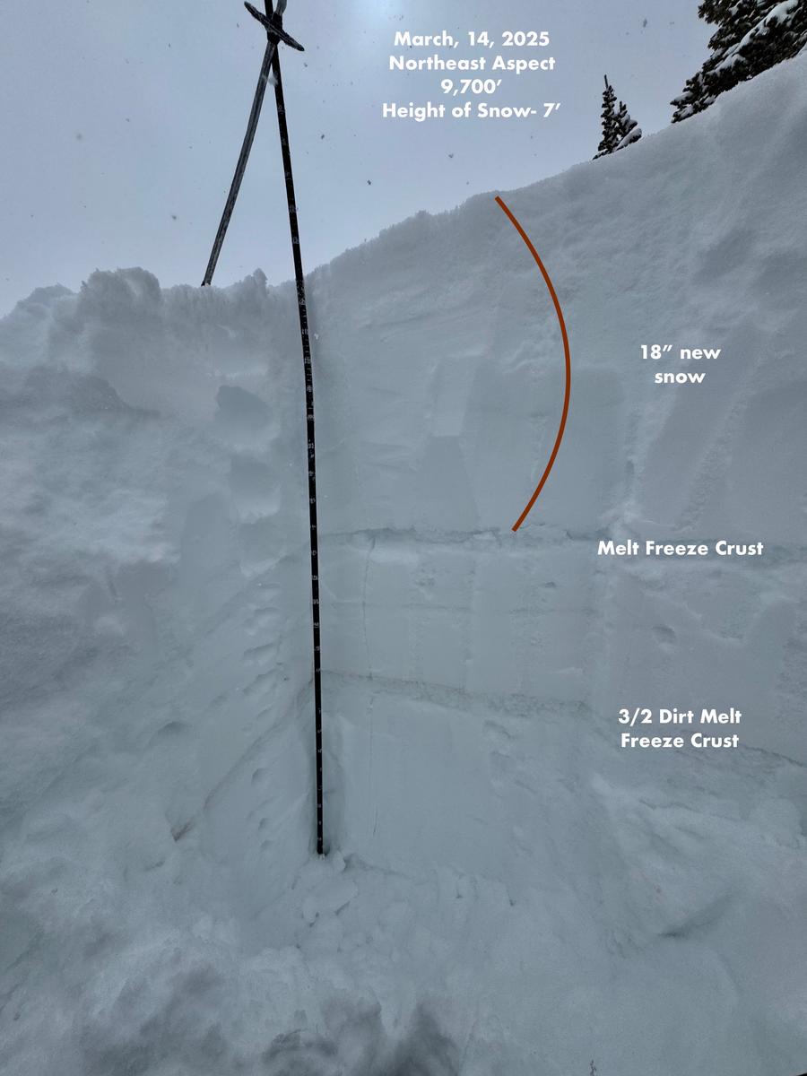
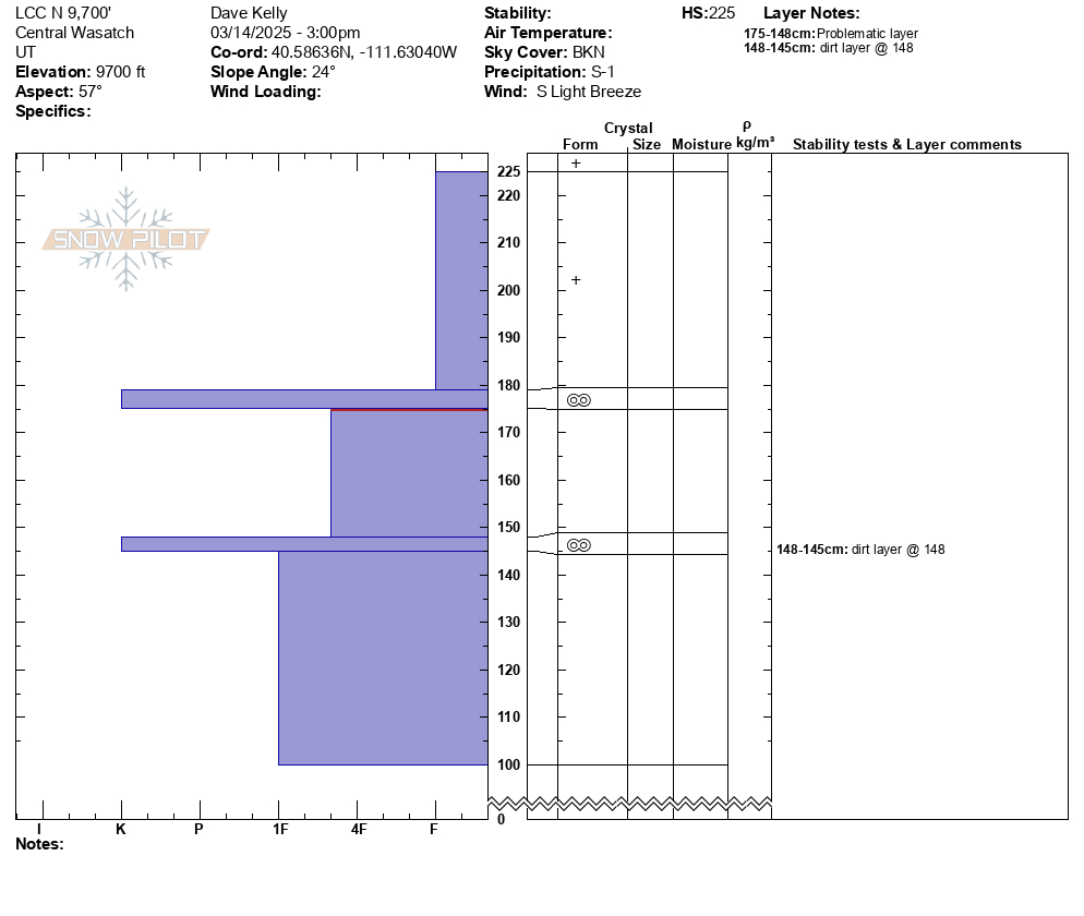
Quick snowpit on a north facing slope at 9,700' in elevation. The total height of snow was 7' (225cm). There was 18" of settled snow with 2 distinct melt-freeze crusts. The lower on (bottom of photo) was most likely the one that formed on March 2nd and had the dirt layer that was previously identified as having some facets around it. Int his location I got no propagation with an extended column test, and on the upper melt-freeze crust ( clean one) I was able to get a shovel shear under the crust (174cm from the ground) with a lot of force.
On southerly facing terrain where I traveled today, the new snow had bonded well to the old snow surface, I didn't see any density changes within the newest snow as the day went on and light wind loading where I traveled. In March, the trick is to get to the new snow before the sun does and the clouds and light snow helped to preserve the snow surface in terrain where I traveled today.
Today's Observed Danger Rating
Moderate
Tomorrows Estimated Danger Rating
Low
Coordinates