Observation Date
3/9/2025
Observer Name
Ryan Huels
Region
Moab
Location Name or Route
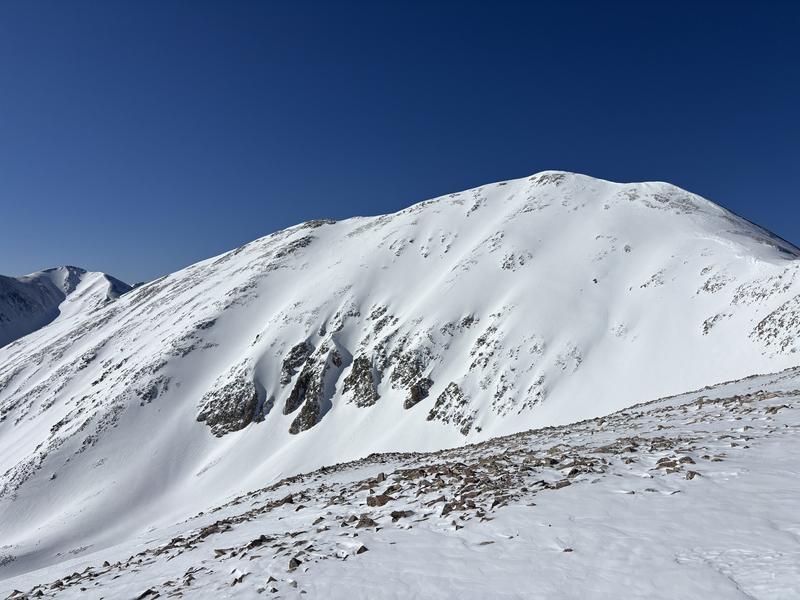
Mt. Waas NE Shoulder
Weather
Sky
Clear
Wind Speed
Calm
Weather Comments
Beautiful spring day in the mountains. Sunny skies all day and very calm with a light breeze out of the SW. Noted NE breeze at the end of the day below the ridge line. Cold in the morning, 18 degrees at 8600’, and then warmed up to 45 degrees at 8600 feet as I was leaving at 230pm. Warm and sunny again tomorrow and then increasing cloud cover until another storm arrives Thursday/Friday.
Snow Characteristics
New Snow Depth
12"
New Snow Density
Medium
Snow Surface Conditions
Powder
Dense Loose
Melt-Freeze Crust
Damp
Snow Characteristics Comments
I spent my time on E and NE aspects. There was fresh snow with spring conditions throughout the day today. It seemed like there was around a foot of medium density settled powder from the recent storm below treeline and a melt freeze crust on sun exposed slopes below 10000'. At and above treeline the storm slab became dense but soft with 1-2" of wind blown snow on top. It made for excellent turning below, at and above treeline. East facing terrain was soft and enjoyable at upper elevations through the noon and became slightly damp in the later afternoon. The snow remained cold on northerly aspects in the trees above 10k. facing slopes became wet and sloppy around noon as well as very "grabby" snow on all aspects below 10k. Expect a melt/freeze crust at low elevations around the compass tomorrow and on mid/upper elevation slopes with a solar aspect. Best bet for soft snow will be sheltered northerlies or solar aspects as they warm.
Red Flags
Red Flags
Recent Avalanches
Collapsing
Rapid Warming
Poor Snowpack Structure
Red Flags Comments
There were several natural avalanches from this recent storm on steep north facing terrain near, at and above treeline. I continue to avoid this terrain with the current snowpack structure that still has a PWL. Watch for wet/loose avalanches on solar slopes with daytime warming. There was some isolated collapsing in my uphill travel below and near tree line but the snow seemed to be gaining strength. Recent winds from SW and NE has loaded sloped on a variety of terrain aspects.
Avalanche Problem #1
Problem
Persistent Weak Layer
Trend
Same
Problem #1 Comments
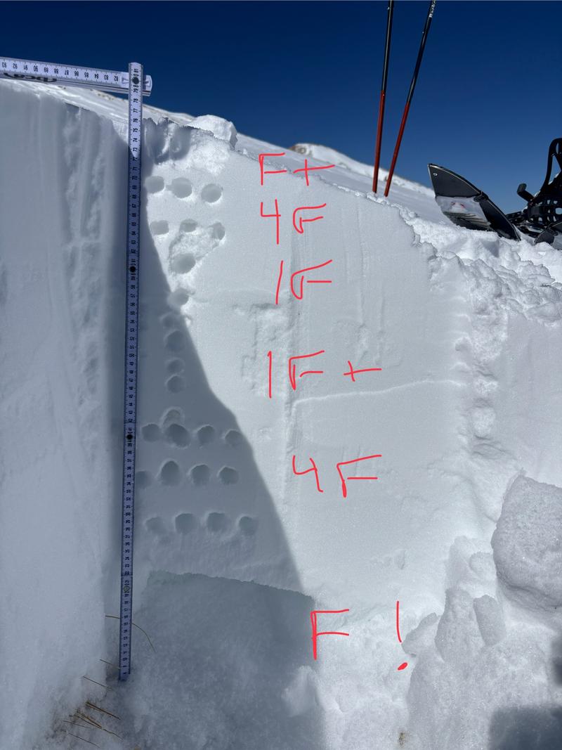
PWL still present as a depth hoar on NE facing terrain in the pit I dug today above treeline. With such a dense slab on top, I still don't have very much confidence and am very cautious on N facing terrain >30 degrees. It does appear that the snowpack is gaining strength though.
Avalanche Problem #2
Problem
Wet Snow
Trend
Increasing Danger
Problem #2 Comments
Daytime heating on solar aspects advises spring time caution for wet slides. Watch for rollerballs, pinwheels and sticky snow.
Snow Profile
Aspect
Northeast
Elevation
11,500'
Slope Angle
17°
Comments
Snow pit at 11500' above tree line. Dense slab sitting on top of a weak layer of facets at the base of the snowpack. With the base of the snowpack being so weak I elected not to ski exposed slopes >30 degrees near and above tree line.
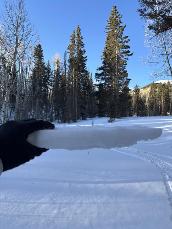
Melt freeze crust at lower elevations and evidence of snowmelt under the surface at mid elevations.
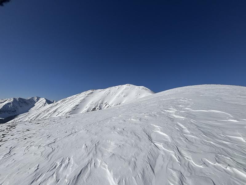
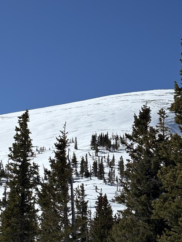
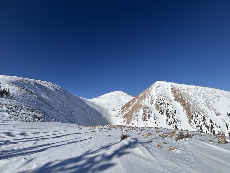
An old slide on steep N facing terrain
Above tree line terrain had some areas of hard wind blown snow towards ridge lines in addition to soft snow.
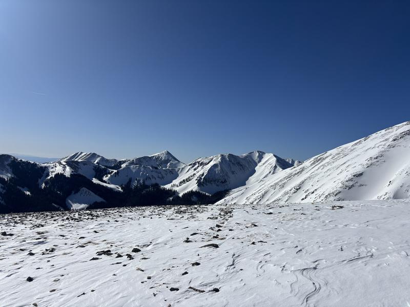
Mountains are looking pretty covered in white with the NE/E face of Waas. Some southerly facing slopes almost completely bare like on La Sal Peak. And, most northerlies are looking covered along with easterlies.
Today's Observed Danger Rating
Considerable
Tomorrows Estimated Danger Rating
Moderate
Coordinates