Observation Date
3/6/2025
Observer Name
Ryan Huels
Region
Moab » Laurel Highway » North Woods
Location Name or Route
North Woods
Weather
Sky
Obscured
Precipitation
Moderate Snowfall
Wind Direction
Southwest
Wind Speed
Strong
Weather Comments
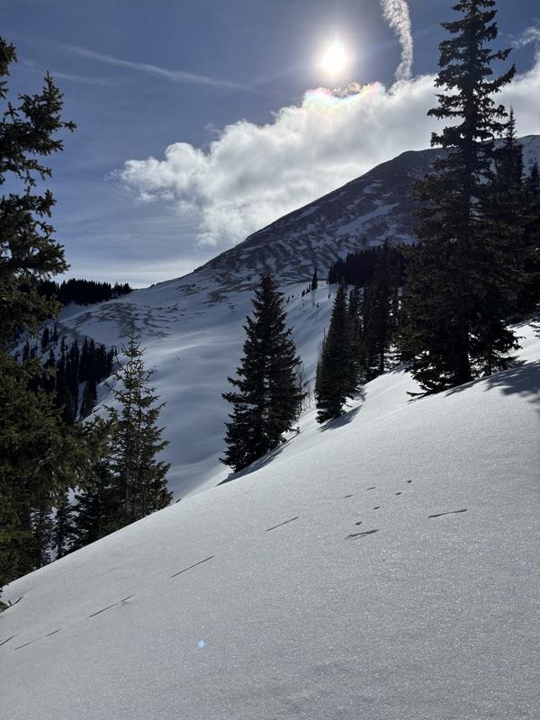
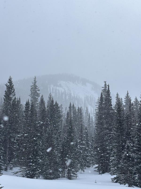
I Started from the winter lot at 9am with moderate snowfall. During my tour up the laurel highway it appeared around 1” of new snow had fallen on top of our most recent storm of 5”. Snow fell on and off, at times heavy, accumulating another 1-2” of snow until around 12pm when the sun made a short appearance through mostly cloudy skies. As I reached the winter trailhead at 130pm clouds were again increasing and snow was beginning to fall again in what looked like a heavy round of snow to come. Winds were moderate to strong with strong gusts all day out of the SW up high and atop ridge lines while swirling winds were present in basins and sheltered areas. I noted two freshly downed trees in burned areas from the high winds. Snow looks to continue tonight into tomorrow morning ahead of a blustery Friday followed by a beautiful, sunny weekend. Snow looks likely to continue through next week.
Snow Characteristics
New Snow Depth
3"
New Snow Density
Medium
Snow Surface Conditions
Powder
Wind Crust
Melt-Freeze Crust
Snow Characteristics Comments
From 9am-130pm around 2-3" of new snow had fallen covering previous laps up the North Woods. In addition, winds were transporting snow onto leeward northerly aspects which were riding the best today. With our previous storm and the new snow, sheltered northerly aspects felt around boot deep and skied excellent. Even at lower elevations where a melt/freeze crust was present around the compass, the new snow softened up turns along the shortcut. Open meadows and exposed SW-S facing terrain had wind blown dust on top of the previous melt/freeze layer. These aspects will likely need more snow unit they are enjoyable to ski/ride. On SW aspects in the trees the snow was soft from the new and wind blown snow. Approaching treeline, above treeline and along tree'd ridges there was a stiff wind slab at the top of the snow pack. I did not spend much time above treeline.
Red Flags
Red Flags
Heavy Snowfall
Wind Loading
Cracking
Poor Snowpack Structure
Red Flags Comments
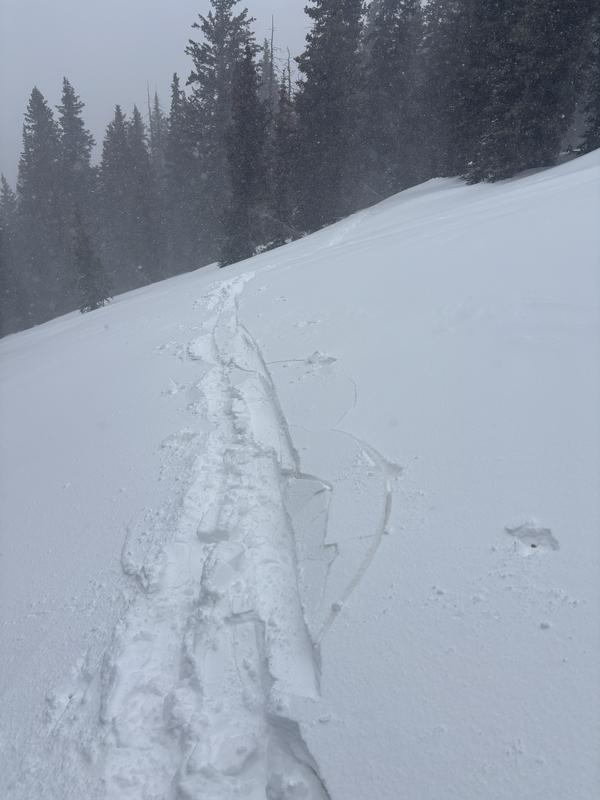
Heavy snow and moderate/strong SW winds through tomorrow is really going to test the poor snowpack structure on the northern half of the compass with new snow and freshly formed wind drifts. There were some signs of isolated cracking near and at treeline in areas where a stiff wind slab has formed from the new and old snow on W-NW-N facing slopes. I will continue to avoid slopes >30 on the northern half waiting to see how they react to this storm being most cautious around treeline.
Avalanche Problem #1
Problem
Persistent Weak Layer
Trend
Same
Problem #1 Comments
I did not dig a pit today, but everything I have this year on northern aspects has had multiple weak layers. With new snow and wind, there is potential to trigger avalanches that could possibly step down into old, weak layers from our long dry spells.
Avalanche Problem #2
Problem
New Snow
Trend
Increasing Danger
Problem #2 Comments
With new snow and high winds a load will develop around the compass. On the lookout for fresh slabs at the new snow/old snow interface on top previously slick South facing terrain in steep areas. New and wind blown snow will settle more onto NW-N-NE-E facing terrain.
Comments
Cracking as you approach tree line where the new snow becomes more stiff.
Around 2-3" of new snow had fallen during my tour, covering tracks and making for great turns.
Blustery conditions with a brief period of sunshine. Winds howled out of the SW all day
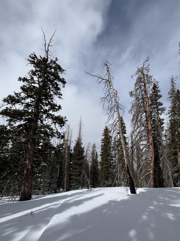
These are old photos, but this is the type of terrain that I will be very cautious around with the new snow. North facing terrain near tree line and in areas with sparsely spaced vegitation. Weak, sugary snow sits underneath.
Today's Observed Danger Rating
Considerable
Tomorrows Estimated Danger Rating
Considerable
Coordinates