Donate to Our Spring Campaign or Bid on our Spring Auction to Support Forecasting

Forecast for the Ogden Area Mountains

Drew Hardesty
Issued by Drew Hardesty on
Saturday morning, January 7, 2023
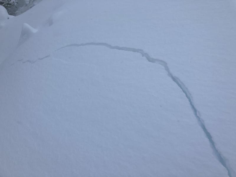
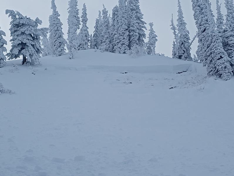
Areas of CONSIDERABLE avalanche danger exist in the mid and upper elevations. Any new snow avalanche may step down into older snow layering, particularly on steep northwest to easterly facing aspects. Conservative decision making remains essential today.
Low
Moderate
Considerable
High
Extreme
Learn how to read the forecast here
Weather and Snow
Skies are partly cloudy. Mountain temperatures are in the mid 20s. Winds are light from the west.
For today, we'll have partly cloudy skies with temperatures rising to the upper 20s. Winds will start to increase from the southwest this afternoon.
Most areas picked up another trace to 2" overnight, pushing storm totals to 16-20" and up to 2.60" snow water equivalent.
Coverage is excellent with up to 80" in the mid-elevations and 35" at the trailheads.

A weak system passes by tomorrow with a much more promising storm slated for Monday night through Wednesday.
Recent Avalanches
Ski area control teams triggered numerous soft slabs in the new snow yesterday.
In the backcountry, observers noted pockety soft slabs within the new snow 1-2' deep and up to 50' wide on a variety of aspects and elevations.
Ad
Avalanche Problem #1
New Snow
Type
Location
Likelihood
Size
Description
New snow soft slab avalanches 1-2' deep can still be triggered today in steep terrain of all aspects and elevations. These new snow avalanches will be reactive to ski cuts and cornice drops. If traveling into the higher elevations, soft slabs of wind blown snow are to be expected in the lee terrain. Shooting cracks are good indicators of instability.
Isolated natural new snow avalanches will also be possible in the steepest terrain today as well, particularly on southerly aspects.
pc: G Harmsen
TREND: STABILIZING
Avalanche Problem #2
Persistent Weak Layer
Type
Location
Likelihood
Size
Description
Our buried weak layers from November are slowly stabilizing but are far from stable. As far as I know, the last natural avalanche into this old layering was just below the Ben Lomond headwall on Wednesday (photo); the last human triggered slide (also on the Ben Lomond headwall) was during last weekend's storm. These were on north to easterly aspects above 8500'.
pc: Brett Fuller
General Announcements
This information does not apply to developed ski areas or highways where avalanche control is normally done. This forecast is from the U.S.D.A. Forest Service, which is solely responsible for its content. This forecast describes general avalanche conditions and local variations always occur.