Donate to Our Spring Campaign or Bid on our Spring Auction to Support Forecasting

Forecast for the Ogden Area Mountains

Dave Kelly
Issued by Dave Kelly on
Monday morning, January 2, 2023
Dangerous Avalanche Conditions exist. Avoid traveling on or underneath slopes over 30 degrees.

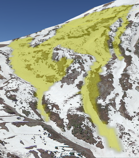
The avalanche danger remains HIGH at the mid and upper elevations. Natural and human triggered avalanches are likely. On northwest through easterly facing aspects, avalanches may step down into older facets, leading to large and destructive avalanches. The lowest elevation terrain has a CONSIDERABLE avalanche danger.

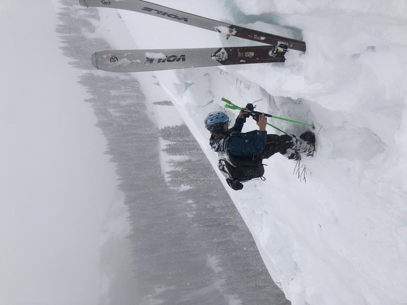
Yesterday ski area and road operations reported large avalanches 4-6' deep and up to 600' wide running on the buried November facets. These avalanches would be unsurvivable.
Low
Moderate
Considerable
High
Extreme
Learn how to read the forecast here
Avalanche Warning
THE FOREST SERVICE UTAH AVALANCHE CENTER IN SALT LAKE CITY HAS CONTINUED A BACKCOUNTRY AVALANCHE WARNING WHICH IS IN EFFECT FROM MONDAY 6AM MST TO TUESDAY 6AM MST...
* WHAT...The avalanche danger is HIGH across northern, central, southeast, and southwest Utah.
* WHERE...For most mountains in Utah and southeast Idaho, including the Wasatch Range, Bear River Range, Uinta Range, Manti-Skyline, Fish Lake Region, La Sal and Abajo Mountains of Southeastern Utah, Pavant Range, Tushar Range, and Cedar City area mountains.
* WHEN...In effect from 6AM MST this morning to 6AM MST Tuesday
* IMPACTS...Very dangerous avalanche conditions exist. Natural and human triggered avalanches are likely on many slopes and may be triggered at a distance. Stay off of and out from under slopes steeper than 30 degrees.
Weather and Snow
Under overcast skies most locations are reporting 3-5" of low density snow. Trailhead temperatures are in the low 20's F while temperatures at 9,000' ridgelines are in the high teens F. Winds are blowing east-northeast 21 gusting to 27 MPH at the ridgelines.
Today, continued light snowfall with 2-5" of snow expected with temperatures 22-29 F. Winds at the 9000' ridgelines will blow southeast 20 gusting to 25 MPH. Winds are forecasted to shift to the north and northwest this afternoon.
Storm totals thus far:
  • Ogden mountains: 23-32"Snow/2.7-4" SWE
  • Upper Cottonwoods: 32"-43" Snow/3.25-4.6" SWE
  • Park City: 27-39"Snow /3.5" SWE
  • Provo mountains: 42" Snow/8.6" SWE
Snow stakes sit at 100-115" in the Cottonwoods and 70-80" along the PC ridge. 70-80" in Ogden, 75-85" in Provo.
Recent Avalanches
Yesterday there were reports of natural and explosive triggered avalanches on all aspects from ski area and highway operations throughout the state. Some of these avalanches were 4-6' deep and 600' wide. These avalanches would have been un-survivable.

Yesterday backcountry skiers on Ben Lomond reported loose dry sloughing on test slopes. Great observation from Amber HERE.

Joe's observation from Ben Lomond highlights the size of the avalanches we've seen over the last few days. The highlighted yellow is the approximate size of the avalanche he triggered from the ridge.
Check out our observations page for the most recent information.
We will continue to assess how the rain may have impacted the PWL at the lower elevations. Any observations are appreciated. Submit observations HERE.
Ad
Avalanche Problem #1
New Snow
Type
Location
Likelihood
Size
Description
Fluctuating temperatures and wind drifting throughout the storm have created a number of layers within the new snow where an avalanche could be initiated. Once a soft slab avalanche of new snow starts it could step down to the November persistent weak layer creating a much larger avalanche. You may not see signs of instability such as cracking or collapsing in the new snow. Avoid getting lured onto steeper slope than you had planned. The new snow alone is deep enough to bury or injure a person that is caught in an avalanche.

Today, I would be giving the new snow layers time to bond and the deeper weak layers time to heal. There is great riding to be had on lower angle terrain.
Avalanche Problem #2
Persistent Weak Layer
Type
Location
Likelihood
Size
Description
This is a significant loading event for our buried weak layers from November. These avalanches will be most problematic on northwest to easterly facing aspects at all elevations, but we cannot rule out the other aspects at this time.

These are unsurvivable avalanches. These slopes may not give you warning signs such as cracking and collapsing. The Reynolds slide stands out to me as an early indicator of other steep slopes with a buried PWL and I would correlate this the Ogden area mountains where I would expect that the same style of avalanche occurred during the storm. I will be giving these slopes some time to adjust to the new snow. Today, I would not travel on steep slopes where the PWL could be present.
General Announcements
Help support the UAC while doing your Holiday Shopping. The UAC's Holiday Silent Auction closes tonight at 8:00 PM MT. Take a look and get your last minute bids in HERE.

This information does not apply to developed ski areas or highways where avalanche control is normally done. This forecast is from the U.S.D.A. Forest Service, which is solely responsible for its content. This forecast describes general avalanche conditions and local variations always occur.