Current Conditions
Saturday was another gorgeous day in the mountains with plenty of sun and decent riding conditions. Southerly wind started picking up in the afternoon and spiked in speed overnight. It's slowed again for now. The sun warmed southerly facing slopes again on Saturday and temperatures stayed mild overnight with readings in the upper 20s to around 30˚F.
Mountain Weather
Today we'll see sunny skies to start and mild temperatures again. Clouds will start to move in mid day and southwest wind speeds will start to increase and could get strong by the end of the day. We have a prolonged period of stormy weather this week. The first impulse will be Monday afternoon which should bring 4 to 8 inches of new snow. A secondary wave Tuesday night through Wednesday should bring a similar amount. I'm a little questionable about how the second half of this storm system will shake out mid week as we will be directly under the center of the low pressure system. This usually isn't a great spot to be in for good amounts of new snow. Regardless, things look active for most of the week with numerous periods of snow that should stack up fairly decently.
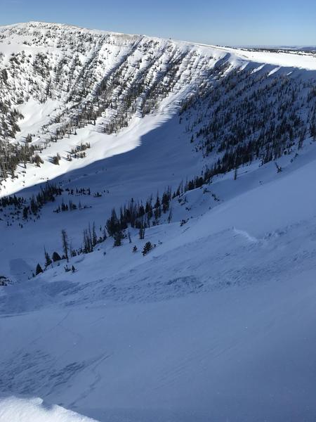
There was one natural avalanche reported on Saturday that released either earlier in the day or perhaps on Friday. Heating from the sun may have been the trigger. It was a shallow soft slab. The weak layer wasn't confirmed but my money is that a layer of near surface facets was the culprit. This is on an east northeast facing slope in the Big Horseshoe at about 10,900'.