Donate to Our Spring Campaign or Bid on our Spring Auction to Support Forecasting

Forecast for the Ogden Area Mountains

Drew Hardesty
Issued by Drew Hardesty on
Tuesday morning, March 21, 2023
Areas of CONSIDERABLE AVALANCHE DANGER exist on steep wind loaded slopes in the upper elevations. A MODERATE danger comprises all other aspects and elevations.
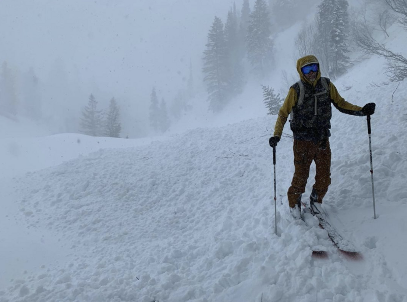
You will be able to trigger both loose dry and soft slab avalanches in steep terrain today. Do not discount the possibility of triggering avalanches well off the ridgelines or on mid-slope breakovers, particularly on some east to south to west facing aspects.
Don't let powder fever get to you today. I wouldn't be surprised to hear of a close call today.
Low
Moderate
Considerable
High
Extreme
Learn how to read the forecast here
Special Announcements
Please consider donating to the spring campaign to help our team implement innovative tools to better provide you with the information you rely on.
Weather and Snow
A violent cold front ripped though the mountains yesterday, complete with ear-shattering thunder, lightning, graupel and roiling west to northwest winds. Happy first day of spring indeed.
All told, storm totals added up to 12-15" of new snow with 1.30-1.50" of snow water equivalent. With frontal passage, winds averaged 35mph from the west with some gusts to 50mph for a few hours.
Currently, skies are overcast with temperatures in the teens and low 20s. Winds are light to moderate from the west. Along the highest ridgelines, they're averaging 25mph with gusts to 35.
We have just a moment to catch our breath before the next series of storms. A powerful storm system pushes down the door this afternoon through early Thursday that'll bring significant snowfall along with moderate to strong winds from the southwest. A rough forecast for snow totals is 15-25". A quick hitting cold front (with additional snowfall) arrives Friday with temperatures plummeting to near 0°F. Unsettled through the weekend with a break for a few days early next week. Whew!
Recent Avalanches
Avalanche conditions became very reactive and touchy within the new snow with the passing of the cold front yesterday afternoon. Many observers reported some naturaling below cliffbands and in some of the steepest terrain. On steep slopes, it was easy to trigger shallow loose dry and 8-12" deep soft slab avalanches on a variety of aspects and elevations. Many of these were running fast on far on myriad crusts, even on north facing slopes up to 7000'. Some of these debris piles would be deep enough to bury a person in a terrain trap. (Brandt photo)
Ad
Avalanche Problem #1
Wind Drifted Snow
Type
Location
Likelihood
Size
Description
12-18" thick soft slabs of wind drifted snow will be found along the upper elevations and to the lee of many mid-elevation ridglines. Brian Smith noted a natural shallow wind slab just like this in the north Birthday Bowl yesterday. They will be most prevalent on north to east to south facing slopes and reactive to ski cuts. Look for smooth and rounded pillowy whales around terrain features. Cracking and collapsing that was evident yesterday during peak instability may not be evident today. Still, I would approach steep wind drifted terrain as if triggering a fresh soft slab is possible. What's my plan?
CORNICES are not to be messed with. They are as big as I can remember and they can crush a skier or rider that either falls over the edge with one.....or crush a skier or rider below.
Avalanche Problem #2
New Snow
Type
Location
Likelihood
Size
Description
Loose dry sluffs and shallow soft slabs in the new snow can be triggered in steep terrain of all aspects in the mid and upper elevations. I suspect they'll run fast and far on the underlying bed surfaces of slick sun and wind crusts or loose faceted grains.
Additional Information

Forecaster's Corner:
What does Acceptable Risk even mean?
Not long ago, I was asked this question by another long-time avalanche professional after sitting in one of our annual fall Snow and Avalanche Workshops. In an avalanche accident this winter, I found - what I believe - to be a clear example. Read more on this HERE.
General Announcements
This information does not apply to developed ski areas or highways where avalanche control is normally done. This forecast is from the U.S.D.A. Forest Service, which is solely responsible for its content. This forecast describes general avalanche conditions and local variations always occur.