Donate to Our Spring Campaign or Bid on our Spring Auction to Support Forecasting

Forecast for the Ogden Area Mountains

Trent Meisenheimer
Issued by Trent Meisenheimer on
Saturday morning, February 4, 2023
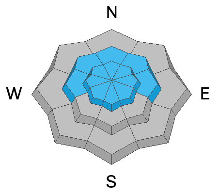
Today there is MODERATE avalanche danger on all upper elevation slopes and on slopes facing west through north through east at the mid elevations for triggering either a soft or hard slab of wind-drifted snow. Southerly winds have created sensitive slabs of wind-blown snow that are likely to be 6-12 inches deep and up to 100 feet wide.

Lose the wind and lose the problem. On slopes where you find soft powder snow unaffected by the wind, you will find better riding conditions and LOW avalanche danger.
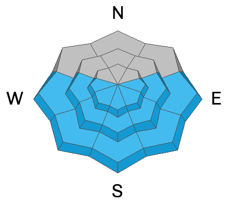
Although unlikely, there is a chance of triggering a slab avalanche 1-2' deep on isolated steep slopes facing west to south to east.
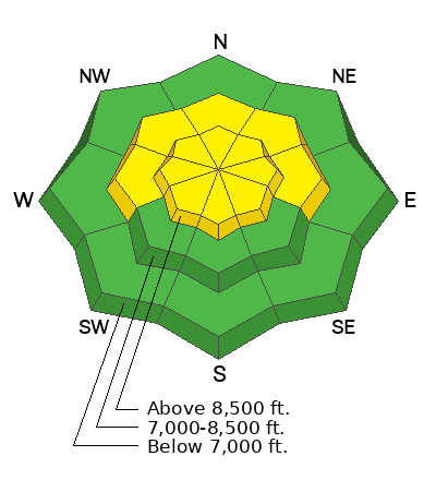
Low
Moderate
Considerable
High
Extreme
Learn how to read the forecast here
Weather and Snow
Under clear skies, the current mountain temperatures range from 20-26 °F. Winds are from the westerly direction blowing 5-15 mph and gusting into the low 20s across much of the upper-elevation terrain. Above 9,000', winds are blowing west-southwest at 25-30 mph.
Mountain temperatures will climb into the upper 30s and low 40s °F at 8000'. Winds will be west and southwest and blow at speeds of 10-20 mph throughout the day. Sunny skies will eventually give way to high clouds as another storm approaches northern Utah. This storm will arrive Sunday mid-morning and last into Monday with perhaps 6-12 inches of new snow.
Recent Avalanches
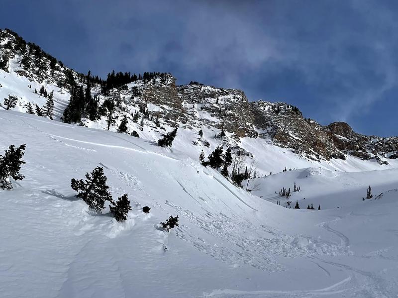
Yesterday backcountry riders reported very strong winds and plenty of drifting snow. In the Wasatch range, backcountry riders reported sensitive hard and soft wind slabs that were 4-7 inches deep and up to 100 feet wide.
See the full list of avalanche activity where you can filter avalanches by region and date.
Ad
Avalanche Problem #1
Wind Drifted Snow
Type
Location
Likelihood
Size
Description
Yesterday's west and southwest winds peaked at 5:00 pm with speeds of 25-30 mph, gusting 40 across the upper elevation ridges. Yesterday's reports of drifting snow and both hard and soft wind slabs triggered by backcountry riders tell us that avalanches are still possible today.
Avalanche Problem #2
Persistent Weak Layer
Type
Location
Likelihood
Size
Description
A thin layer of faceted snow that is buried 1-2' deep on occurs on many slopes facing west to south to east. On southerly-facing slopes, this faceted layer may sit just above a thin sun crust. This was the weak layer for the Birthday Bowls avalanche on Monday and was also the likely weak layer in the Chilly Peak Slabs on Saturday. On Wednesday, Drew visited the Birthday Bowls avalanche (which was likely triggered by a moose) and is summarized in this video:
General Announcements
This information does not apply to developed ski areas or highways where avalanche control is normally done. This forecast is from the U.S.D.A. Forest Service, which is solely responsible for its content. This forecast describes general avalanche conditions and local variations always occur.