Donate to Our Spring Campaign or Bid on our Spring Auction to Support Forecasting

Forecast for the Ogden Area Mountains

Drew Hardesty
Issued by Drew Hardesty on
Thursday morning, February 16, 2023
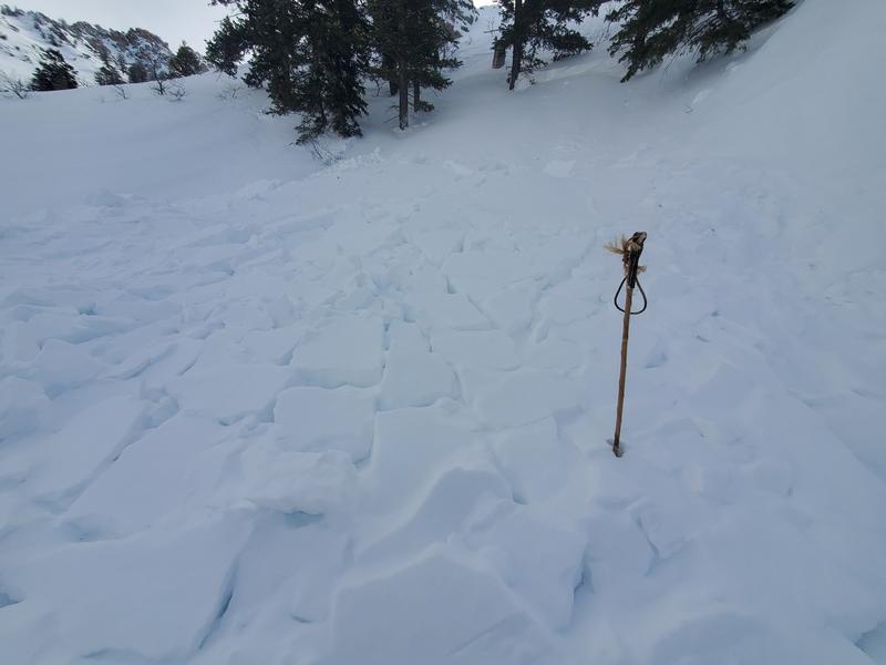
Pockets of MODERATE avalanche danger exist for shallow slabs of wind drifted snow on many aspects and elevations. Human triggered avalanches are possible. Owing to the yesterday's east winds, look for unusual wind loading patterns.
The danger will trend toward LOW by the afternoon.
Low
Moderate
Considerable
High
Extreme
Learn how to read the forecast here
Weather and Snow
Cold mountain.
Cold crescent moon.

Skies are clear.
Mountain temperatures are in the single digits.
Winds, mercifully, have lost steam and are blowing 10-15mph from the north-northwest. Along the higher elevations, they are blowing 20-25mph with gusts to 30.

Today's weather will be clear and cold. Mountain temperature will slowly struggle into the mid to upper teens. Winds will be light from the northwest.

High pressure briefly builds across the area through tomorrow and Saturday with a cut-off Low pressure system diving well to the south. The northern branch of the split-flow system will graze northern Utah Saturday night and produce a couple inches of snow. Another disturbance moves through on this northwest flow Sunday night into early Monday. These, mind you, are just setting the table for what looks to be a significant and complex weather system for early/mid next week. It's still a few days away and a number of details will become more clear, but it initially looks wet, warm, and windy. It has my attention.
Recent Avalanches
Nothing good comes from an east wind. The east (from the north and east) winds tormented even the low elevations yesterday. Trent and Doug Wewer on Cutler and Derek DeBruin on Rodeo Ridge found wind damage up high but no sensitive wind slabs anywhere.
Ski area avalanche teams also found little evidence of avalanche conditions BUT one observer low in the Banana Chute in the Snowbasin backcountry found a natural hard slab avalanche 2' deep and 40' wide. It was on a cross-loaded northeast facing slope at 6800'. In the central Wasatch, there was also pockets of activity on mid/low elevation cross-loaded slopes.

Find all the recent observations HERE.
Ad
Avalanche Problem #1
Wind Drifted Snow
Type
Location
Likelihood
Size
Description
Pockets of lingering slabs of wind blown snow will be littered across the compass at the mid and upper elevations. Don't discount the lower elevation bands either. Be on the lookout for drifts with unusual loading patterns, owing to yesterday's moderate to strong East winds. Shooting cracks are indicators of localized instability.
Additional Information

Forecaster's Corner: This forecast was a difficult one. Avalanche danger is a function of many things: sensitivity, size, distribution, and character.
I do think that many of yesterday's slabs of wind blown snow will have settled out and become less sensitive...but if I were heading into the mountains today, I would be approaching any steep terrain and rollover as if it held a shallow wind slab. And I would not make any associations: this piece of terrain was stable, therefore the next similar slope will be stable as well. I would bump my plans for the "extreme" terrain to tomorrow or early weekend.
Maybe I'm just getting old and more cautious. I know what it looks like when things go wrong.
General Announcements
This information does not apply to developed ski areas or highways where avalanche control is normally done. This forecast is from the U.S.D.A. Forest Service, which is solely responsible for its content. This forecast describes general avalanche conditions and local variations always occur.