Avalanche conditions are very dangerous across most of the State of Utah as discussed by our staff in this video.
Currently: Heavy, dense (10-12% density) snowfall began around 7 pm on Thursday night with 6 am snow totals roughly 8" of snow containing 0.8-1.2" of water.
Temperatures range through the teens.
West/southwest winds were quite strong throughout Thursday and overnight, averaging in the 20's and 30's mph with gusts in the 50's mph at the highest elevations. Winds have subsided somewhat this morning, but are still moderate to strong out of the west/southwest.
For today, 2-4" of dense snowfall is forecasted, with the steadiest snowfall during the afternoon. Winds will be from the west/southwest and moderate to strong. At the mid elevations, winds will average in the teens with gusts in the 20's and 30's mph. Upper elevation ridges will average in the 30's with gusts in the 40's and 50's mph. Temperatures will rise into the upper 20's F.
Heavy snowfall and continued strong winds overnight and into Saturday morning.
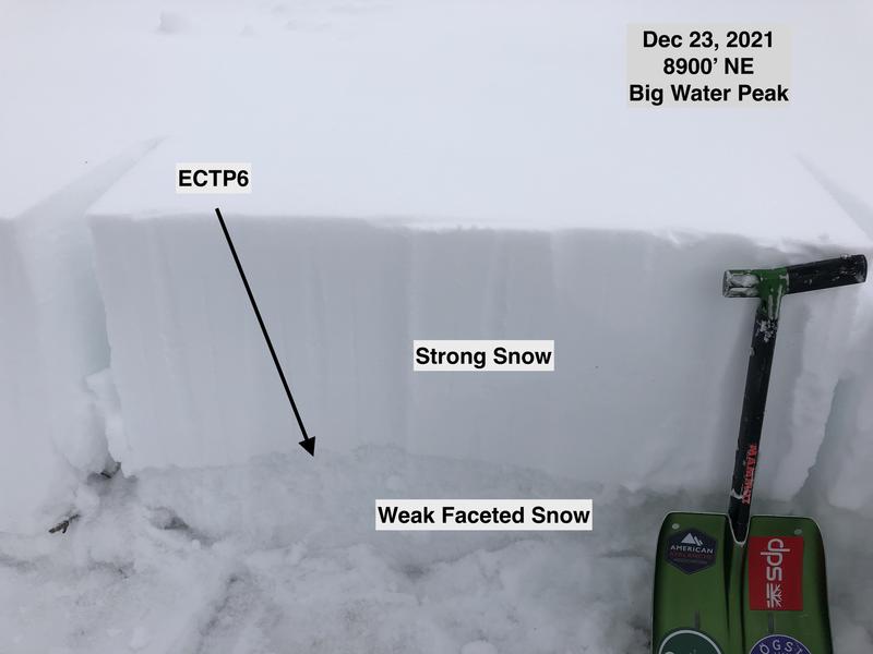
No avalanches were reported from the backcountry on Thursday. But we have seen numerous backcountry avalanches this past week with several near misses in the Salt Lake mountains. The snowpack structure on northerly aspects in the upper elevations in the Ogden mountains is just as weak as is found in the Salt Lake and Provo mountains.
Although centric to Salt Lake, you can get caught up by reading our
Week in Review where we summarize significant snow and weather events from this past week.