
Forecast for the Ogden Area Mountains

Issued by Dave Kelly on
Monday morning, January 30, 2023
Monday morning, January 30, 2023
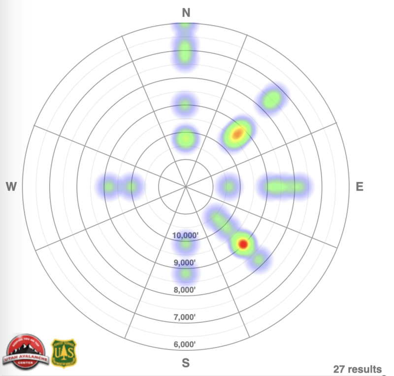
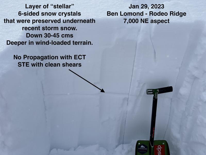
The avalanche danger is CONSIDERABLE on upper elevations for wind-drifted surface snow. The avalanche danger is MODERATE for new snow avalanches running on small grained facets now buried 1-2' below the surface at mid and upper elevations. The avalanche danger is LOW in lower elevation terrain. Expect to see dry loose avalanches in steep terrain and on any solar warmed slopes.
Cold temperatures may keep natural activity at bay today, however human triggered avalanches are still likely in upper elevation terrain. There is world-class riding to be had on lower angle slopes and I will be assessing the new/old snow interface before traveling onto terrain approaching 35 degrees.

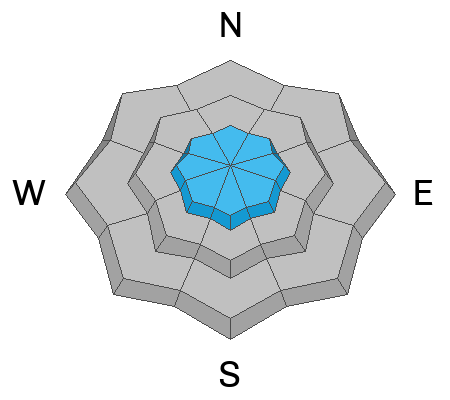
Low
Moderate
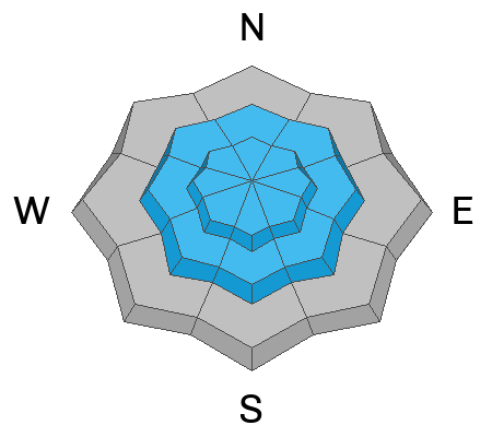
Considerable
High
Extreme
Learn how to read the forecast here