Donate to Our Spring Campaign or Bid on our Spring Auction to Support Forecasting

Forecast for the Ogden Area Mountains

Greg Gagne
Issued by Greg Gagne on
Friday morning, January 13, 2023
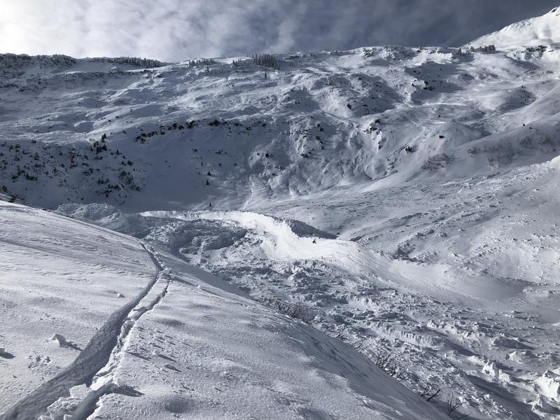
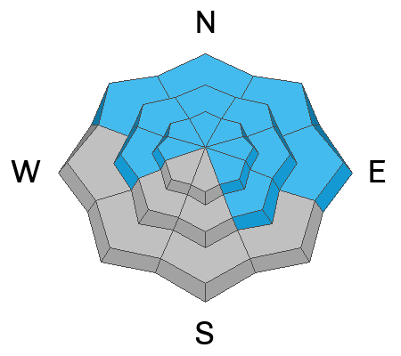
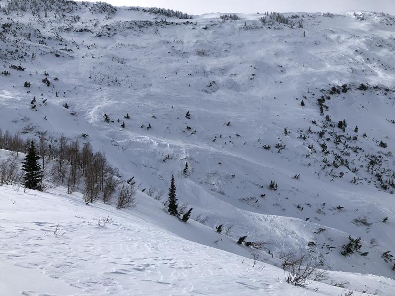
The avalanche danger is MODERATE on all slopes. Watch for fresh wind drifts 6-12" thick at the upper elevations. On aspects facing northwest through north and east at the mid and upper elevations, avalanches may break down several feet deep and hundreds of feet wide.
Warm temperatures may cause both natural and human-triggered small, wet-loose avalanches on all aspects at the low and mid elevations.
Low
Moderate
Considerable
High
Extreme
Learn how to read the forecast here
Weather and Snow
This Morning: Temperatures have slowly risen overnight with temperatures ranging through the 30's F. Winds are from the south/southwest and are light through the mid elevations with gusts in the teens, but are much stronger at upper elevations, averaging in the teens with gusts into the upper 20's mph. Warm temperatures and sunshine have left behind a crust on most sunny aspects.
Today: Mostly-cloudy skies with temperatures rising well into the 30's F. South/southwest winds will increase by late morning, with gusts in the 20's mph at mid elevations and into the 40's mph at upper elevations.
This Weekend: Increasing winds today are in advance of a series of storms which should bring snow throughout much of this coming week. A few inches of accumulation by late Saturday afternoon, with more substantial snowfall expected Sunday and into the Dr. Martin Luther King holiday on Monday.
Recent Avalanches
Thursday's clear skies made for prime avalanche viewing with plenty of evidence from the Wednesday/Thursday natural avalanche cycle. Avalanche activity include along the Ogden Skyline as well as most of the Ben Lomond headwall between Ben Lomond and Willard Peak (photo below). The crown is estimated at 5-6' deep and 4,000' wide. The southerly faces of Ben Lomond also were active, with avalanches visible from North Ogden (look at the full observation from UAC Logan forecaster Toby Weed).
Ad
Avalanche Problem #1
Persistent Weak Layer
Type
Location
Likelihood
Size
Description
Although the PWL of faceted snow has gained significant strength and is now buried over 4' deep in most areas, heavy/dense snowfall and strong winds over the past several weeks will ultimately find a weak layer, and it is possible that portions of the avalanche activity on the Ben Lomond Headwall ran on this PWL. Although triggering one of these avalanches is unlikely, consider these consequences if you choose to get onto a slope where the PWL can be found. Suspect spots include heavily wind-loaded slopes in thinner snowpack areas, such as slopes adjacent to rocks.
Photos of Ben Lomond where some portions of the slides may have broken down into the deeper PWL.
Avalanche Problem #2
Wind Drifted Snow
Type
Location
Likelihood
Size
Description
Today's south/southwest winds may create sensitive soft slabs of wind-drifted snow at the upper elevations, especially this afternoon as wind speeds increase. Watch for cracking in fresh wind drifts as an indication of unstable snow. Travel well back from corniced ridgelines as large cornices have developed this past week and today's winds may only increase their size and sensitivity. (How far back? Yesterday, my partner and I were traveling along the corniced ridgeline on Gobbers Knob above Alexander Basin and we were staying at least 30' from the edge.)
General Announcements
This information does not apply to developed ski areas or highways where avalanche control is normally done. This forecast is from the U.S.D.A. Forest Service, which is solely responsible for its content. This forecast describes general avalanche conditions and local variations always occur.